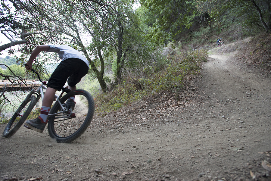
In recent revisions to the management plan for the Open Space District’s fire roads and trails—the first comprehensive strategy since the district’s creation in 1972—county staff dropped many proposed constraints on trail mileage and use after widespread public outcry, leaving lingering questions about the process and unaddressed issues for mountain bikers.
At a rowdy public hearing characterized by shouting and booing last November, opposition to restrictive language in the draft Road and Trail Management Plan united a broad cross-section of hikers, dog walkers, bikers and equestrians. A controversial system would have separated the 34 Open Space preserves into four management zones, the strictest of which, in Gary Giacomini, Cascade Canyon and the Bolinas Lagoon, had a ratio of decommissioning two acres affected by trails for every acre of new trail building. Language in the plan also suggested citations would be issued for off-trail hiking and off-leash dogs.
County planners altered the zone system to focus on resource conservation areas, instead of types of visitor use; all policies for those zones, including the decommissioning ratios, have been eliminated. Policies on informal and social trails were slackened to allow continued pedestrian use unless officially decommissioned. The staff also did away other prohibitions on pedestrians walking off-trail, though hikers will be encouraged to be mindful of environmental impacts. Dogs are still forbidden from the off-trail experience, and there will be specific zones where leashes are required.
Part of the reason for the distress was a perceived skirting of the public process, particularly for San Geronimo Valley residents who felt their historical freedoms to tread on “social trails” were suddenly being taken away. In written comments and at the November meeting, outdoor enthusiasts were asked to limit their feedback to the draft environmental impact report, even though the draft of the plan had been released on the same day. In recent memos, staff implied the comment period was for both documents, though the initial notice of availability in October only mentioned public comment for the E.I.R.
Staff found the vast majority focused on the merits of the plan, and decided to weigh them before issuing revisions. At a meeting last Thursday at the Civic Center, some open space commissioners questioned whether the confusion would mean another public hearing, since those who followed instructions may not have had a fair chance to comment on the plan.
In an even longer delay, a recirculation of the E.I.R. may be needed to reflect the recent changes, Greg Zitney, the chair of the commission, suggested, calling the situation “kind of unprecedented.”
The plan and the E.I.R. were drafted concurrently, a “departure from the way that it’s sometimes done,” because staff wanted each document to inform the other, said Ron Miska, deputy parks director.
According to the California Environmental Quality Act, an E.I.R. is required “to inform the public and responsible officials of the environmental consequences of their decisions before they are made” if there is a significant or adverse impact.
Complex and meticulous by its very nature, the E.I.R. for this plan has been in development since scoping began in February 2011, and a final draft of the E.I.R. had been expected this spring.
If the revised policies—to the management zones or decommissioning ratios, for example—alter the calculations of environmental impact to a significant degree, park staff may be forced to alter the process or make themselves liable to a lawsuit for being insufficiently informative about the environmental impacts of the plan. Even if the data would result in the same outcome, CEQA holds that omitting significant information could render the document useless and the process unlawful.
Some of the impacts may not be significant, since a few revisions were only clarifications of contradictory language, not changes in policy. Regarding off-trail pedestrians, for example, the earlier plan stated, “No off-road or off-trail use will be permitted for any user types, except to water or rest horses or pack animals,” which seemed to conflict with another policy, “Pedestrians are strongly encouraged to stay on system roads and trails.” (Ms. Dahl apologized for the mistake at the meeting, stating they were not trying to be so “draconian.”)
An attorney with background in CEQA will provide an opinion to the county staff on how to proceed. “I’m happy to hear you are consulting with counsel,” Mr. Zitney said.
As those issues are being decided internally, the largest issue for the public is about access for mountain bikers. With many issues resolved for hikers, the coalition that unified to express concerns in November has splintered into factions over bikers, with one group considering the activity dangerous and environmentally destructive and the other arguing for a recreational activity they say has been unfairly stigmatized.
The tone of this debate was set at the beginning of last week’s meeting with a presentation by Parks Director Linda Dahl showing illegal ramps and trails that rogue mountain bikers have built in county preserves and Golden Gate National Recreation Area, including one with ramps close to eight feet tall in Mill Valley—a sight more appropriate for X Games than spotted owl and red-legged frog habitat. Another illegal, 2.5-mile trail at French Ranch resulted in dozens of trees being cut down, Ms. Dahl said.
“This is not just 1969 anymore, when these were private lands; not 1979, when we were starting to grapple with new uses; not 1999; or even 2009, when I just started,” Ms. Dahl said. “We are seeing all kinds of changes and challenges.” She said these trails were not built by misguided teenagers, “not bad boys on the weekends. It’s people coming in with buckets at midnight.”
To some mountain biking advocates—many of whom condemned the illegal trail building—these ramps are an example of the lack of access, with bikers so desperate for a place to ride that they have begun to make their own. To Vernon Huffman, the president of Access4Bikes, it’s not 1979, and the new plan for trails should reflect what has changed over the four decades since a ballot initiative created the public lands to make trails available to a rapidly growing user group.
Advocacy groups have tried to change perceptions of mountain bikers with volunteer initiatives, and many have been involved in trail maintenance initiatives, Mr. Huffman said. The Marin County Bicycle Coalition has partnered with the Marin Horse Council for a program called Tails and Tires to teach younger mountain bikers about horses and how to interact safely on the trails, said Tom Boss, director of the coalition’s Off-Road program. (The first workshop will be on March 1 at Novato Horsemen’s stables.) The Bicycle Coalition and Access4Bikes have also distributed and installed hundreds of bike bells as a friendly way of alerting others from a safe distance, Mr. Boss added.
“All it takes is that one negative encounter to wipe out ten positive ones,” he said. “We’re trying to create as many positive interactions on the trails as possible.
During the public comment period last Thursday, many bikers said the presentation came out of left field. The discussion of illegal activity focused on bikes while ignoring or downplaying other problems like illegal trails built by hikers or marijuana farms and homeless encampments on public lands, Mr. Boss said.
Many of the illegal trails highlighted had also existed for some time—the Mill Valley ramps for about 17 years and the San Geronimo Valley trail for roughly three years, Mr. Huffman said. “I’d rather be thanked for strong volunteerism than have a 17-year-old trail exploited,” Mr. Huffman said.
“This plan is in its final stages after a three-year ordeal,” he continued. “To have an inflammatory presentation seemed confusing and deliberate. It seemed to be a convenient distraction to pull attention away from our numbers.”
According to a survey of trail users by the parks department, nearly one-quarter of users are mountain bikers, compared to 0.4 percent use by equestrians. But bikers have access to only one-quarter of narrow trails, while 91 percent are available to horses, Mr. Huffman said.
Mr. Huffman’s group and the Bicycle Coalition have been lobbying for more access since the process started. They’ve received some of the things they asked for, such as removing the ratios for decommissioning trails and creating a process for existing trails to become officially recognized.
As the plan evolved, staff also changed policy to retain redundant trails, with the option of single-use—creating longer loops for bikers or reducing the potential for conflict by separating user groups.
“I think we are very close,” Mr. Boss said. “We think that the revisions make it more clear how to provide a better experience, to provide new trail opportunities and reduce the impact all at the same time.”
But some of Access4Bike’s suggestions have been ignored, Mr. Huffman said. His group has suggested numerous alternatives to reduce potential conflict. Alternate-use days, which would allow bikers only every other day while hikers are free to use the trails any day they want, has been implemented successfully on the Tahoe Rim Trail, Mr. Huffman said. Directional trails could eliminate fears of speeding by preventing bikers from going downhill, he added. (Alternate-use days are not being considered, but directional trails may be implemented, Mr. Miska said.)
The group has also called for the removal of language in the plan that targets “extreme” or “dangerous mountain biking activities,” without reference to any other groups, like hikers climbing trees or rocks or horses galloping or lunging. These revisions may still be forthcoming as additional chapters of the plan are reviewed, Mr. Miska said.
“We think the overall tone of the document could be improved to welcome mountain bikers, not simply tolerate us,” Mr. Huffman said. “We need this plan to be a progressive document that can still be effective in 15 years, not already dated upon delivery.”