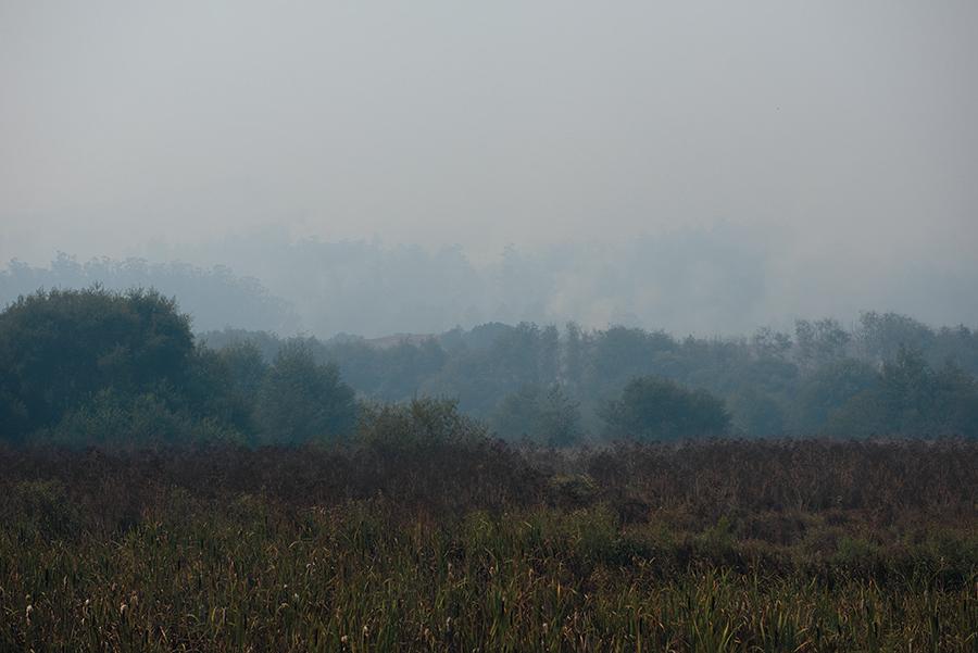
Firefighters made significant progress on the Woodward Fire this week, but West Marin’s largest fire in 25 years continues to smolder in the dense wilderness, filling the air with toxic smoke more than two weeks after its ignition.
Fog and lower temperatures are keeping the flames calm, allowing crews to box the fire between ridges, roads and trails. Control lines have been secured by dozers, hand crews and backburns around 95 percent of the 4,000-acre fire. The lines will be tested by warmer weather and faster winds.
The marine layer, which forms when air over the chilly Pacific Ocean moves inland, is the biggest factor in the fire’s behavior, as it generates fog, humidity and lower temperatures. Those conditions can either aid or frustrate firefighting efforts, and they are especially strong in the summer.
Fog benefits the firefight by dampening fuels and blocking the sun from drying out plants, but it also creates challenges. Often, air support has been grounded because visibility is too poor, and crews haven’t attempted backburns because vegetation is too moist.
“The marine layer is our friend, but like any friend, if he stays too long, then he eats all your food, he drinks all your beer and he annoys the heck out of you,” operations chief Mike Granger said.
The marine layer also mixes with the smoke and prevents it from dissipating, which is why air quality has been so unhealthy in Marin.
Because the timber in the interior of the fire is extremely thick and unreachable islands of green remain inside the burn area, the fire will continue to produce smoke until a few inches of rain end the fire season, which isn’t predicted for months, Marin County Fire chief Jason Weber said. Fortunately, when the weather warms and dries, as it usually does in the fall, the fire will burn cleaner and fog won’t trap the smoke, improving air quality.
“This is putting out an unprecedented amount of smoke,” Mr. Weber said. “It’s pretty nasty, and it’s going to be that way for a little bit.”
About half of the Woodward Fire is burning in the footprint of the Vision Fire, which marks its 25th anniversary in October. Firefighters are doing all they can to prevent the blaze from reaching the diseased bishop pines on the Inverness Ridge that torched in the Vision Fire. The pines are thin and flammable, and they border homes. So far, the blaze has stayed in chaparral and uninhabited forests mixed with firs, bays, oaks and pines.
Firefighters are using the ocean as an anchor point and working on control lines to the north, east and south. In areas by the beach, crews have found success in the coastal scrub, which reaches seven feet high in some spots. Although retardant can’t fall through, dozers and hand crews can cut lines.
Firefighters have placed over two miles of hose on the northern dozer line, with hundred-foot hoses branching off a main line for mopping up hot spots. That edge is at the top of a ridge, and the goal is to prevent burning in the next drainage, which aligns with the usual wind patterns and leads up into Inverness Park.
The southern edge, about six miles from Bolinas, is calm thanks to favorable winds and successful backburns. The town’s evacuation warning was lifted this week, and residents benefited from clearer skies.
The biggest concern for operations managers is the northeastern edge, which threatens park buildings and 90 homes. Firefighters are making their stand along two roads: Limantour Road and the Bear Valley Trail, a fire road. On windy days, when branches fall or an ember blows across one of the roads, they quickly extinguish any ignition.
The work is dangerous: Two firefighters were taken to the hospital last Thursday after debris from a burning tree fell on them, and later that day, a five-foot-wide Douglas fir toppled over the fire road, blocking an exit route. Large bays also crack across the roads, and crews hear trees fall in the forest interior.
“That continues to happen, and that continues to be a very big concern for the safety of our fire personnel,” operations chief Brandon Cichowski said.
Hand crews are staying within 100 feet of the fire’s perimeter to reduce the risk of falling trees, and unmanned aircraft specialists are deploying drones. These fly over unburnt areas with plastic spheres containing chemicals that react in flames after they fall to the ground. The drones can fly when helicopters cannot, transferring risk away from firefighters and pilots.
Along control lines, firefighters are intentionally lighting the understory and directing flames toward the wildfire’s edge, so the fire can’t advance. The backburns give firefighters wiggle room and protect the canopy from a crown fire; about half of the fire’s acreage was created by these burns.
This weekend, firefighters performed a backburn in Kule Loklo, the replica Coast Miwok village near the Bear Valley Visitor Center, protecting the wooden structures while the dry grass blackened.
Early in the week, the marine layer got stubborn, and backburns were limited because the humidity remained above 80 percent into the afternoon. For a backburn to be successful, humidity needs to fall below 70 percent so that fuels are dry enough to burn, Mr. Granger said.
The mood on the front lines is calm and methodical, as firefighters wait for more action. More wind and warmer temperatures in the 70s are forecast for this weekend, which could wake the fire up.
The blaze was sparked on Aug. 17 during a rare lightning storm, and smoldered for a day before a lookout camera detected a column of smoke in the Woodward Valley.
A crew of firefighters on the scene of a slow-moving fire two miles away hiked to the ignition point, but they were outgunned. Without engines or hoses, the crew resorted to sawing and axing a perimeter around the fire.
They requested air support, but Cal Fire faced hundreds of lightning-sparked fires across the state, and planes and helicopters were unavailable. The fire flashed through the forest, growing to more than 700 acres in five hours. A cloud of smoke billowed over the ridge, and residents were told in a series of evacuation warnings to be ready to go on a moment’s notice.
After two days of steady growth, help arrived for firefighters on the ground. Air tankers dropped over 68,000 gallons of fire retardant, while amphibious planes and helicopters dropped nearly a half-million gallons of water pulled from Tomales Bay, Nicasio Reservoir and ranch ponds.
A federal incident management team with experience from Alaska to Australia was called in from Montana to oversee operations, and hundreds of firefighters arrived to work. Bulldozers cut large control lines through the earth, and operations managers identified a box in the geography in which the fire could be contained.
Since the fire grew out of control, it’s burned an average of about 250 acres per day to its current size of 4,538 acres. The box around the fire is roughly 5,000 acres.
Three streets off of Bear Valley Road remain under an evacuation order, and deputies are patrolling the empty neighborhoods. The sheriff is considering lifting both the order and remaining warnings soon. Defensible space inspectors completed their checks and wood-chippers helped remove brush at homes near the fire this week.
West Marin residents have shown their support for firefighters by placing signs of gratitude along roads, and local restaurant owners are stepping up with meals. Café Reyes has donated pizzas, and the Bovine Bakery and Saltwater Oyster Depot are making almost 100 dinners a night, all funded by individual donors.
At Saltwater, the tables are empty, but the counters are overflowing with locally produced veggies, bread and meat. Owner Luc Chamberland heard firefighters weren’t fond of their federally contracted meals because the food is processed, so he decided to offer his own catering service. It’s kept his employees working, and he can support local producers who may have lost restaurant contracts. Cooks make and deliver meals each evening to the former San Geronimo Golf Course, which has transformed into a large basecamp for the crews dedicated to the fire.
For Jenna Rempel, a cook at Saltwater, the meal preparation keeps her busy during a stressful time. She lives on Drakes View Drive, less than a mile from the fire, so she’s been staying with a friend in Stinson Beach to be safe.
“I don’t know what I’d be doing if I wasn’t working. Probably going crazy,” she said while slicing Star Route Farms tomatoes to put on burgers.
In a sign of colliding disasters, Ms. Rempel wears two masks, one to prevent smoke inhalation and another to prevent spreading the coronavirus.
After months of fractional income due to Covid-19, the unhealthy air has dealt yet another blow to businesses on the coast, as the park is closed and visitors are urged to stay home.
In Point Reyes Station this week, thick smoke settled and a red-orange sun glowed over the town, whose tourist-serving businesses are already facing a dire financial outlook. Restaurants, limited to takeout and outdoor dining, don’t want to put diners outside in the smoke, and inns don’t feel comfortable hosting guests while the area is under an evacuation warning.
“We get hit with one disaster after another,” said Susan Howard, an owner of the Cottages at Point Reyes Seashore, where all the bookings were canceled. “We have no income, and we still have all of our bills.”
For longtime residents of West Marin, the current blaze brings back memories of the 1995 Mount Vision Fire, a larger and more destructive event that burned 45 homes in Inverness Park and over 12,000 acres in the seashore. Just two days after it started, the Vision Fire was nearly three times the current size of the Woodward Fire.
Like the Woodward Fire, the Vision Fire smoldered in a remote area before it was picked up by the wind and blown through dry, heavy fuels. First responders struggled to access both fires early on, and they had limited resources.
But the weather, geography and ignition source of the two fires are different. The Woodward Fire started a mile from the beach, then spread up the ridge through a mixed forest, with thicker trees. The Vision Fire started from an illegal campfire on the ridge, and then spread to the beach through thinner bishop pines that lit like matchsticks. The humidity was lower, and the winds were stronger.
Yet many areas of forest are even more of a fire hazard now than they were before the Vision Fire, which caused vegetation to bounce back with abundance. Bishop pines rely on fire to regenerate, and after the 1995 fire, the number of pines exploded. That forest is now suffering from an infection of pine pitch canker fungus, and dead branches and trees are strewn over the forest floor.
Greg Jones, the fire management officer for the seashore, said the park service is doing the best that it can with limited resources. He took the position of overseeing fire management for all national parks in the Bay Area at the end of the last year, and he’s still developing a strategy for reducing the fire threat. The park service is focusing its efforts around private property, so the area that is burning now was never considered for a controlled burn or mechanical treatment.
“We feel we get the most bang for the buck to really just work right around the park service boundaries, where we border up against our neighbors,” he said.
Along those borders, the fire threat remains high, as unburnt piles sit on the ridge, dead trees are ready to fall and the ground is littered with woody debris.