As a new decision approaches for a much-criticized plan to drop rodent poison on the South Farallon Islands, a group of activists have coalesced around an unlikely flash point: an enigmatic array of stones in the Point Reyes National Seashore. 

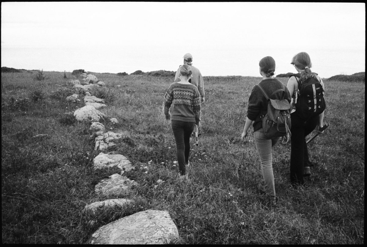
About a mile and a half past Pierce Point Ranch, two straight lines of overgrown granite boulders go unnoticed by many hikers on the Tomales Point Trail. The lines, each of which consists of hundreds of rocks, have an uncertain history. They are undoubtedly human-made, but park officials and local researchers have not found consensus on when, or by whom, they were created. 

Now, in connection with an upcoming hearing on the Farallones rodent plan, Indigenous activist Lou-Anne Makes-Marks, who has Coast Miwok and Kashia Pomo roots, is arguing that the lines, and a few surrounding rock mounds, are megalithic artifacts constructed in prehistoric times as part of a mortuary complex that culminated at the Farallon Islands. Bolstered by independent research conducted by hydrogeology consultant Stephen Janes, Dr. Makes-Marks hopes to highlight the sacred history of the Farallones in advance of Dec. 16, when the California Coastal Commission will determine whether the federal plan to poison invasive mice on the islands is consistent with its own regulations. 

“What I do in my research is proactive,” Dr. Makes-Marks said. “If I hear of a site that’s under threat of destruction, I will do the research and present that research to defend it. I dug deeper into whether or not that was a sacred place for the Coast Miwok, and I managed to put together the pieces of the puzzle quite quickly.”  

The United States Fish and Wildlife Service and Point Blue Conservation Science have planned for years to rid the Farallones of their dense population of invasive mice, which were introduced to the islands by ships in the 19th century. The project before the coastal commission involves using helicopters to drop 1.45 tons of grain pellets spiked with the anticoagulant rodenticide Brodifacoum over the islands.

The Farallones are home to the largest seabird nesting colony in the contiguous United States, and Fish and Wildlife officials say the mice are wreaking havoc by attracting burrowing owls, which then turn to preying on birds like the ashy storm petrel later in the winter. Fish and Wildlife found the plan would have a long-term benefit on the ecosystem despite short-term adverse impacts, and a 2019 Point Blue study showed it would likely benefit petrel populations. 

Yet Fish and Wildlife and the coastal commission have received hundreds of public comments opposing the project, and environmental activists have joined forces against it. “This is trading damage to a bunch of species for a claim that it is going to benefit one species,” said Richard Charter, a senior fellow at the Ocean Foundation and a prominent critic of the plan. “It does more harm than good.” 

Mr. Charter and others argue that the anticoagulant will spread through the food chain and have widespread negative effects on birds and other animals on the Farallones and beyond. When gulls and raptors eat the poisoned mice, they argue, those birds will suffer secondary poisoning, and the pellets will be ingested directly by invertebrates and other mammals. 

Mr. Charter said Fish and Wildlife should reconsider the plan and use a less harmful contraceptive bait, which the agency could explore as an alternative in a supplemental environmental impact statement. “Brodifacoum is kind of like the Covid of rodenticides,” he said. “It transmits too easily from one animal to the next.” 

The coastal commission planned to make its consistency determination more than two years ago but was delayed when Fish and Wildlife temporarily withdrew the matter to answer concerns from commissioners. Warning of long-lasting toxic effects on wildlife, Commissioner Roberto Uranga at the time compared the action to “dropping a nuclear bomb” on the islands. The pandemic delayed the hearing further. 

As the new date approaches, opponents of the plan have stepped up their efforts. Dr. Makes-Marks co-authored an e-book, “Our Poison Free Sanctuary,” with Mr. Charter. In it, she wrote that Fish and Wildlife neglected to consider the sacred aspects of the Farallones as part of the traditional cultural landscape of the Coast Miwok and Ohlone people, whom she said were not consulted. 

“Both the Ohlone and Coast Miwok have thus far been disenfranchised in the planning process for the poisoning, leaving important traditional ecological knowledge, in the context of ecocultural considerations, missing from the decision-making process,” she wrote.

Dr. Makes-Marks also began to publicize her theory that the rocks at Tomales Point are spiritually connected with the Farallon Islands and Indigenous traditions. Oral histories indicate that the Coast Miwok believed the dead entered the afterlife by traveling out across the Pacific Ocean. Interpreting ethnographic interviews with Coast Miwoks Tom Smith and Maria Copa from the 1930s, Dr. Makes-Marks identified the lines of rocks as the remnants of a spirit mortuary called the “Spirit Jumping-Off Rocks,” which she believes may have been built thousands of years ago. 

Tomales Point lies at the center of the path that spirits of the dead traveled in Miwok mythology, she wrote, citing Ms. Copa’s account. One of the lines points northeast to Mount Saint Helena and the other points southwest to the Farallones, both sacred sites for the Coast Miwok and the Ohlone. “It is plausible that the Point Reyes/Farallon Islands complex stands among the most ancient traditional cultural places in North America that have been identified to date,” she wrote. 

In her paper, Dr. Makes-Marks also mentions the seashore’s general management plan amendment, echoing other environmental groups that opposed extending ranching leases and objected to culling tule elk. She consulted with the Coast Miwok Tribal Council of Marin, a group that also opposed the park’s plan. In June, the council accused the park of ignoring a 2008 proposal for an Indigenous archaeological district in favor of the dairy ranches district that was ultimately recognized in 2018. 

Stephen Sciallo, a headman of the tribal council, said Tomales Point represents a deeply significant area for Miwok people, and he was interested to hear from Dr. Makes-Marks about the stone arrays. He said they appear to him to be a purposefully built structure, and not a fence, but said their history was “inconclusive.” 

The Federated Indians of Graton Rancheria, the federally recognized tribe based in Sonoma County that represents Coast Miwok, has not singled out the site publicly, and Mr. Sciallo said the tribe’s chairman, Greg Sarris, has expressed doubt that the stones are part of Miwok history. “It’s a mystery and I really don’t know what to believe,” Mr. Sciallo said. “The only way to find out would be to do an archaeological dig, and I think Graton would put the kibosh on that.” 

Even if the tribe’s leadership was confident that the stones represented Miwok heritage, the matter would be kept confidential as part of the tribe’s relationship with the park, to discourage looting and damage caused by visitors. Researchers at Sonoma State University have identified more than 150 Miwok archaeological sites in the seashore, though the park keeps the confirmed number confidential. Many are mounds of soil called middens that contain artifacts like shells and sometimes human remains; a large stone construction like the one at Tomales Point would be atypical. 

In response to the Light’s questions about the stones on Tomales Point, Mr. Sarris wrote that “all information regarding archaeological sites and cultural resources must remain confidential.”

Dr. Makes-Marks said she understands the tribe’s caution. “Until a site is actively endangered, it’s actually preferable to the Indigenous community to keep it low key,” she said. Still, she believes the seashore and the Farallones are under immediate threat from environmentally unsound practices. 

The theories of Dr. Makes-Marks and Dr. Janes contradict previous conclusions made by archaeologists and historians. In 2014, Archie Williams High School science teacher Michael Wing conducted a study of the stone lines with two students, Katherine Iida and Emily Wearing, that was published in the peer-reviewed journal California Archaeology. Their study acknowledged that oral tradition tied the stones to the Miwok, but it found much more evidence that they were part of an unfinished wall built by ranchers in the 19th century, likely as a property boundary. 

In the line, longer stones are placed lengthwise and shorter ones crosswise, a technique used by New England stone wall builders, Mr. Wing and his students found. Solomon Pierce, the early rancher for whom the surrounding former Pierce Ranch is named, was originally from Vermont. The wall closely resembles an unfinished Anglo-American stone wall, Mr. Wing argues, and there is no similar known wall built by Miwok people. He said Dr. Makes-Marks and Dr. Janes didn’t provide good evidence for their claims. 

“Archaeology has always been a magnet for sensational claims and pseudo-science and these papers fit squarely into that tradition,” Mr. Wing said. “…It’s easy to project your own worldview onto unusual features like this.”

The stone lines are not interpreted by the park, and Paul Engel, the seashore’s archaeologist and acting cultural resources program manager, expressed uncertainty about their origin. In 2014, after Mr. Wing’s study, Mr. Engel told the Light he believed it was probably a property demarcation dating back to the early ranching era. Now, he said he is less sure of that, though he didn’t want to speculate on any connection to Coast Miwok heritage. 

“I can’t speak to whatever that traditional association may be, because I don’t have the knowledge of it,” Mr. Engel said. “It’s not something that’s been communicated in any way to the park.” 

He added, “Archaeology is all about looking at a collection of materials and trying to understand the behavior that created it. Any time you have an isolated feature, oftentimes it’s hard to make more of it than just itself.”

According to West Marin historian Dewey Livingston, the rocks appear as a line on a hand-drawn 1862 United States Coast Survey map that was surveyed over the course of the preceding decade. Since the map marked animal enclosures, it indicates that the stone lines may have been used for a corral, Mr. Livingston said. But he pointed out that although the lines were likely used for ranching operations, they could have predated them, and their unusual construction poses questions. 

“There are rock walls in Marin that are very old, but they’re more traditionally made,” Mr. Livingston said. “The fact that these are such huge stones doesn’t seem to fit with that.”