
Sir Francis Drake was looking for a way home. Between 1577 and 1580, on the last leg of a circumnavigation of the world in which he had sought to expand Britain’s maritime power and score Peruvian gold from the Spanish, Drake traveled north along the West Coast hoping to find an open passage to the Atlantic.
After turning around in impassable waters off the Oregon coast, the legendary navigator headed south for over 300 miles in search of a safe bay where he could stop to repair and re-provision his ship. It is now thought that he finally made landfall at Drakes Bay in 1579.
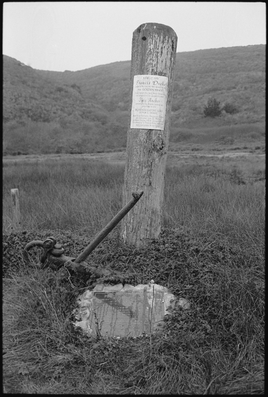
Commemorating the first documented contact between Europeans and California’s native people, the site became a National Historic Landmark District in 2016. It was largely the outcome of over six decades of research undertaken by the Drake Navigators Guild, which submitted the landmark application in the ‘90s.
On Saturday, Sept. 16, the guild’s president, Ed Von der Porten, a nautical historian and archaeologist whose co-authored book “Discovering Francis Drake’s California Harbor” depicts the story of the landing, will host an event for the Nicasio Historical Society that includes an illustrated presentation and a modest hike to Drakes Cove—where Drake anchored his ship—at low tide.
“It’s not an easy site to get to, since there’s no road or trail access and you have to be careful and time your visit with the tides,” Mr. Von der Porten said.
Though no one can be 100 percent certain that the Golden Hind anchored in Drakes Bay, and theories of other locations remain, the National Historic Landmarks Program—which is administered by the National Park Service, though it’s the Secretary of the Interior that designates new properties—says it is “the most probable site of the first encampment of Englishmen on U.S. shores.”
“There has been a lot of very detailed work, well-disciplined work on this for decades,” said historian Dewey Livingston. “I think they’ve come up with the answer.”
Research into ship construction, seamanship, navigation, cartography, botany, zoology, hydrography, meteorology, anthropology and archaeology by a wide range of scholars contributed to the account told in Mr. Von der Porten’s book.
Many of the details were also provided by accounts recorded by the chaplain aboard Drake’s ship, a common practice for maritime voyages at the time. Ming porcelain shards found in Coast Miwok village sites provided additional physical clues.
Drake and his crew spent about five weeks at the site in 1579, calling it Nova Albion—“Albion” being the Roman name for Great Britain.
Limantour Spit, within Drakes Bay, is also thought to be where, 16 years after Drake landed, a storm grounded and sank a Manila Galleon—a Spanish trading ship that made round-trip voyages between Mexico and the Phillippines—called the San Agustin. There, the captain, Sebastião Rodrigues Soromenho, and his men watched helplessly from the shore, according to the National Park Service.
The area—from Drakes Cove to Limantour Spit—is now known as the Drakes Bay Historic and Archeological District, and is one of 2,500 sites nationwide recognized by the national historic landmark program for their exceptional value or quality in illustrating or interpreting United States’ heritage.
“The Drakes site is of that kind of importance, as the first landing of Englishmen on the shores of what is now North America,” Mr. Von der Porten said.