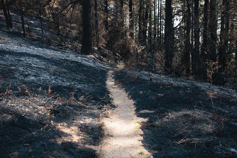
A team of specialists and scientists trekked into the heart of the Woodward Fire burn area last week, and they came away with a sense of what it will take to stabilize the reshaped wilderness: time, money and a lot of work.
As the fire continues to smolder, the park service is coming to understand the restoration effort that lies ahead, following a 10-day visit by the Burned Area Emergency Response, or BAER, team. Made up of a hydrologist, an archaeologist, a mapping specialist and a forester, the team completed their assessment on Saturday. The report comes with a one-year work plan and recommendations for emergency funding.
Their findings are mostly good news. Only 9 percent of the 4,929-acre fire burned with high severity, and most of the flames cleaned up the understory in a healthy manner. Weather modeling shows that park infrastructure will remain safe even in a major storm.
Yet the burned land is now ripe for the new growth of invasive plants, meaning years of monitoring and removal lie ahead. The creeks are also littered with logs and branches, and the trails are crossed by burned debris.
“We are going to be in a race against time, because a lot of what needs to be done is around erosion control,” said Dave Press, the seashore’s chief of natural resources. “So we want to get things buttoned up before the first rain arrives.”
Because of the ongoing threat of falling trees, 10 burned trails will likely stay closed through the winter. The park is pursuing funding to hire docents to educate visitors about what happened in the fire, including both the benefits and the ongoing risks. Once these employees are stationed at trailheads, Limantour Road and unburned parkland south of Bear Valley Trail can reopen, Mr. Press said.
The restoration consists of three phases. The first is suppression repair. Firefighters typically carry out this work as containment grows; they plant seeds on disturbed areas, like dozer lines and helipads, and remove immediate threats, like dead trees near the road. But with hundreds of fires burning on the West Coast, suppression repair has been left for the park service to carry out. This work is underway, and most of the hazard trees on the perimeter have been felled and chipped.
The second phase is comprised of the BAER team’s assessment and the year of work that follows. BAER teams respond to fires on federal lands, and this team was relatively small and came for a short period of time. Members flew in from the Cascades to the Channel Islands, each bringing a specific expertise. They worked from sunup to sundown, both in the field and using technology like satellite imagery.
Their primary purpose was to assess risk to people and infrastructure, such as roads, culverts and buildings. The Woodward Fire was mostly contained to wilderness, and the park headquarters are the only buildings in the burn area.
The team used satellite data to create a map based on how light reflects off the landscape, both before and after a fire. Where the change is more dramatic, the burn is more severe. A hotter burn creates more risk of erosion, flooding, vegetation mortality and invasive plant spread.
Hydrologist Spencer Higginson thinks about the aftermath in terms of water drainage. A forest has three layers with which to capture rain, he said. The canopy catches some, the ground floor of duff captures more, and the soil soaks up the rest. Once these layers are saturated, runoff occurs.
That drainage process changes after a fire. In the Woodward Fire, the canopy was mostly spared; the leaves, needles and branches on the ground ignited, and, where the fire burned hot, the soil became hydrophobic, meaning it repels water instead of absorbing it. Modeling shows that over three inches of rainfall in six hours would create about 20 percent more runoff, which is manageable. Many of the fires Mr. Higginson analyzes show twofold or threefold increases in runoff, with the most severe burns increasing runoff by a factor of 10.
The fire burned hottest on the west side of the Inverness Ridge, where the coastal scrub is thick. There, runoff will be more severe, but no buildings are threatened and the drainages are separated by long ridges, so massive flows of water can’t gain momentum. In a storm, no one is generally out there, so Mr. Higginson isn’t concerned.
To ensure that a heavy rain doesn’t flood Bear Valley Creek, Coast Creek and culverts along Limantour Road, the BAER team suggested emergency funding to remove dead branches from the waterways, with a focus on floating wood. They also recommended having staff monitor drainages during the first storms.
The archaeologist on the BAER team recommended stabilization work at one cultural site in the burn area, team leader Jack Oelfke said. Because the site is protected, he did not describe or locate it.
The BAER team hiked on the Woodward Valley Trail but avoided other trails on the fire’s interior because sounds of falling trees indicated it was not safe to do so. On the trails they could access, crews will need to do significant clearing and construction before reopening to the public. The fire burned retaining walls and damaged erosion control materials, creating sinkholes.
Trail work falls into the third phase of the post-fire work, which focuses on rehabilitation. These projects are not of immediate need, like replacing the picnic tables at Sky Camp. Funding for such work is competitive between national parks, but the seashore can apply for federal money for three fiscal years after the fire.
Invasive plants are an area of concern in both the short and long term. Of the roughly 900 species of plants in the seashore, more than 300 are non-native. Many of these species have become a natural part of the environment, so the park focuses on plants that reshape habitats—altering soil chemistry, replacing native species and threatening biodiversity. In beach dunes, i’ts iceplant and European beachgrass. On the ranches, it’s wooly distaff thistle and fertile capeweed. Along creeks, it’s Japanese knotweed.
Pampas grass, French broom and Scotch broom are most likely to infest the burn area, Mr. Press said. These weeds move into areas where plant cover is bare and the soil is devoid of nutrients.
Since the area is designated wilderness, the preferred method of removal is manual labor. Hand pulling and weed wrenches are effective only if park staff can get out early and start work before plants become deeply established. If not, the park may use mechanical tools like chainsaws, and the work will have to be justified. When absolutely necessary, herbicide treatment may be required to remove invasives.
“My hope is we can really stay up on things, and only the lightest touch will be necessary,” Mr. Press said.
To this day, the park is still working on removing pampas grass from the area that burned in the 1995 Vision Fire.
The BAER report seeks no funding for wildlife management, but it does mention three species of concern that may be impacted, though some in positive ways: northern spotted owls, steelhead trout and the Point Reyes mountain beaver.
The fire burned through six northern spotted owl habitats, but park staff hasn’t seen whether nests were destroyed. Monitoring will be more difficult this year because of tree hazards, so Mr. Press said the park may install devices to record owl calls at night.
Steelhead trout could benefit from the fire because trees that fell along creeks will slow the water’s flow, creating new habitat.
The Point Reyes mountain beaver is not monitored like the owls are, so the effects on the subspecies, endemic to the peninsula, will be harder to gather. The beavers tend to burrow into the ground rather than fleeing fire as other four-legged mammals do.
Limantour Road and all trails, beaches and campgrounds south to Stewart Trail and west of Highway 1 remain closed to visitors. This includes Bear Valley, Sky, Baldy, Old Pine, Meadow, Woodward Valley, Laguna, Fire Lane, Z Ranch, Horse, Coast, Glen and Greenpicker Trails; Sky, Coast, Glen and Wildcat Camps; and Limantour Beach.